Exploring Ma Pi Leng Pass Ha Giang – A must-see stop in the Ha Giang Loop!
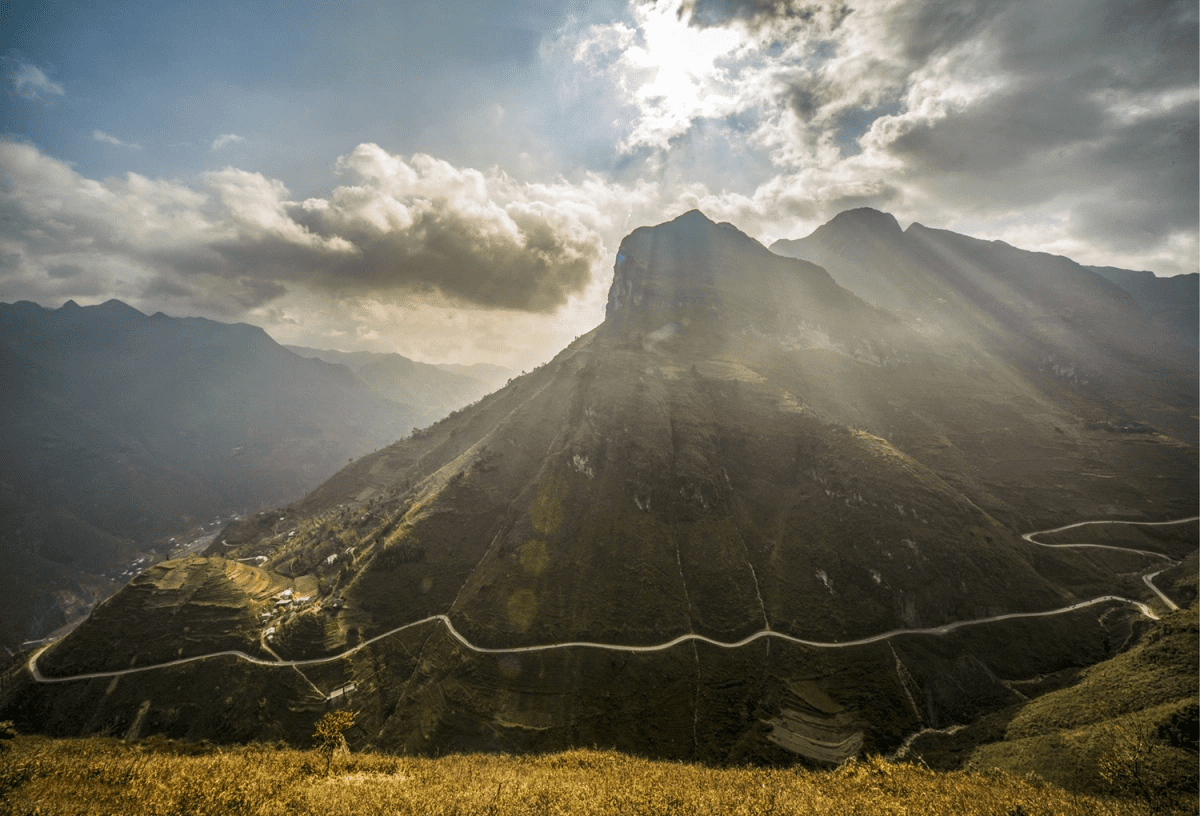
In the north of Vietnam, there is a dramatic mountain pass called Ma Pi Leng – one of the Four Greatest Mountain Passes. Stretching approximately 20 kilometers along National Highway 4C between Dong Van and Meo Vac in Ha Giang Province (now it is Tuyen Quang Province), the Ma Pi Leng Pass allows you to experience many interesting and gorgeous natural settings on the way, such as the Nho Que River or Heaven’s Gate.
If you are planning for the breathtaking Ha Giang Loop, Ma Pi Leng will definitely appear as a must-visit place on your entire journey. Thrilling, majestic, and wild are the feelings you can expect at Ma Pi Leng Pass! But do you know the optimal way to explore it, without missing any hidden viewpoints & impressive photo spots? Let’s unravel all the “secrets” about Ma Pi Leng Pass Ha Giang, including the best cafe and travel tips, in this article.
TL;DR – Ma Pi Leng Pass Ha Giang
- Ma Pi Leng Pass sits on Highway 4C between Dong Van and Meo Vac – roughly 150 km from Ha Giang City.
- The pass is part of the UNESCO Dong Van Karst Plateau Geopark and is called “Tứ đại đỉnh đèo” (one of the Four Great Mountain Passes) of Vietnam.
- The main viewpoints include Cong Troi (Heaven’s Gate) at the summit, the Mi Po Coffee, the Skywalk cliffside trail, and multiple pull-offs overlooking the Nho Que River.
- The Dong Van → Meo Vac direction offers a gorge on your left, making it an ideal side for photography.
- The dry season (October–April) is the safest and most scenic window to visit.
Location and Significance
| Category | Key Takeaways |
| Location | Ma Pi Leng Pass – between Meo Vac & Dong Van, northern Vietnam |
| Meaning | “Horse’s nose bridge” (Tay language), describing its sharp ridge (too high & steep, that even the horses breathe slowly, or looks like the horse’s nose bridge). |
| Road | Part of Happiness Road (184 km loop route) |
| History | Built 1959–1965 by 1,300+ workers; most difficult section |
| Status | National scenic monument (since 2009) by Vietnam’s Ministry of Culture, Sports and Tourism |
| Geology | Inside Dong Van Karst Plateau Geopark (UNESCO Global Geopark) |
| Highlight | Tu San Canyon (700–800m deep) + Nho Que River (jade-green water) |
Ma Pi Leng Pass sits along the famous Ha Giang Loop, spanning the border between Meo Vac and Dong Van districts in Ha Giang Province, northern Vietnam. The pass name translates loosely from the local Tay language as “sống mũi con ngựa” (horse’s nose bridge) – a nod to its sharp, curling ridgeline shape.
The road itself is part of what Vietnamese people call the Happiness Road (Con đường Hạnh Phúc), a 184 km route connecting Ha Giang City with Dong Van and Meo Vac. Construction ran from 1959 to 1965, completed almost entirely by hand – over 1,300 young volunteers from 16 ethnic groups, 8 northern provinces, carved this road out of sheer limestone using manual tools. The Ma Pi Leng section was the most dangerous and technically demanding stretch of the entire project. When you ride it today, you’re traveling a monument as much as a road.
In 2009, Vietnam’s Ministry of Culture, Sports and Tourism officially designated the Ma Pi Leng scenic landscape as a national-level monument, recognizing both its geological significance and cultural heritage. The pass also falls within the Dong Van Karst Plateau Geopark – one of Vietnam’s two UNESCO Global Geoparks – which spans about 2,356 km² of ancient limestone formations, some dating back 500 million years.
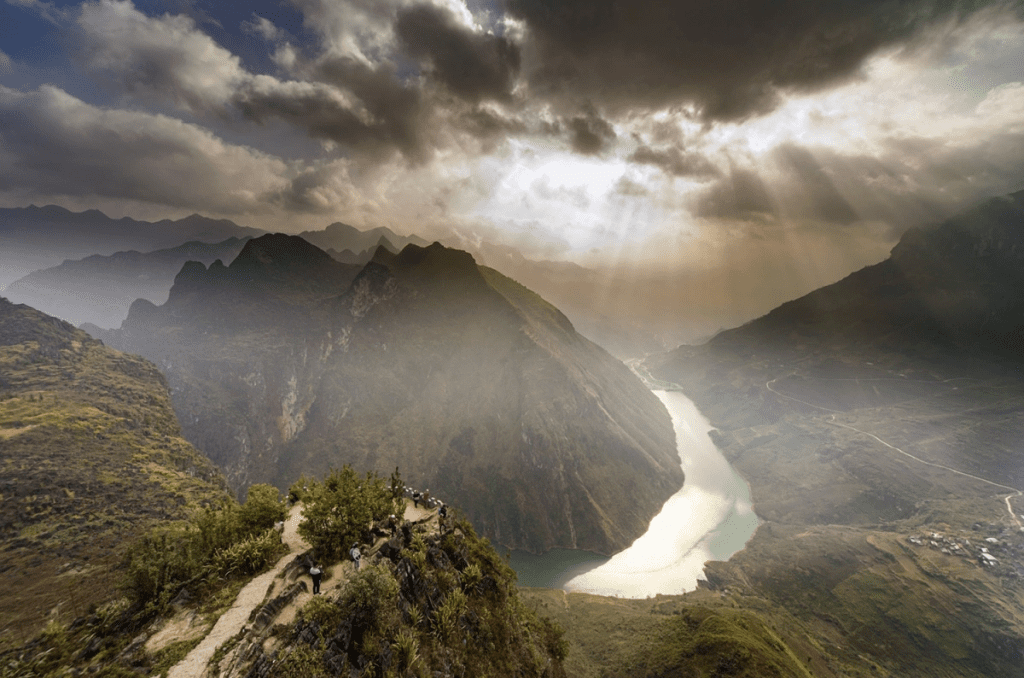
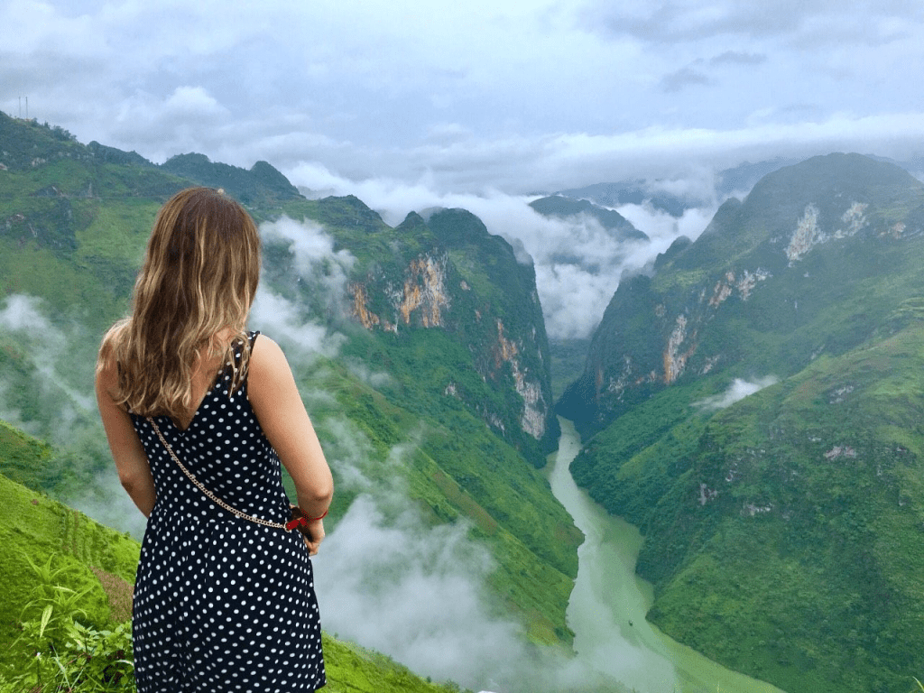
The gorge below the pass, known as Tu San Canyon, reaches depths of around 700–800 meters and is considered the deepest river canyon in Southeast Asia. The Nho Que River running through it takes on a distinctive jade-green color caused by light refraction through the limestone-filtered water – a color that looks almost artificially vivid in photos but is entirely natural.
Best Viewpoints and Photo Spots
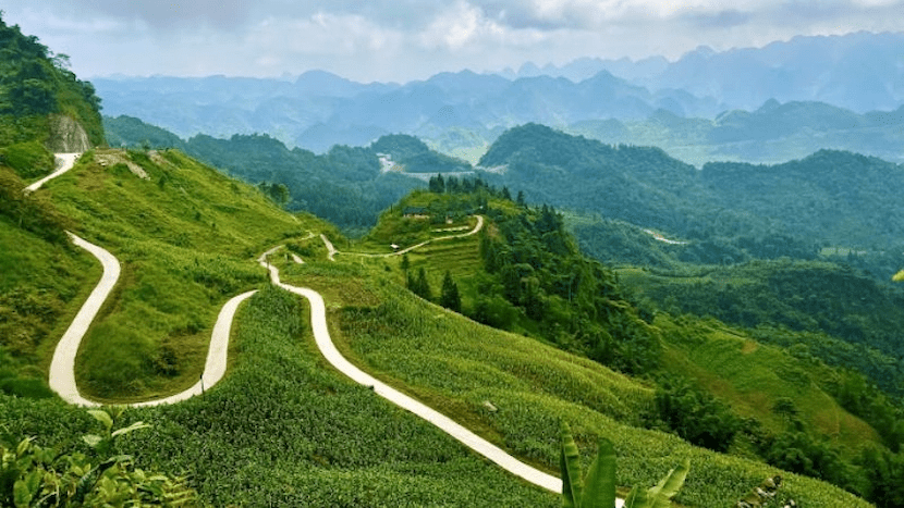
The entire 20 km stretch of Ma Pi Leng Pass is a continuous sequence of viewpoints, but a few stand out as essential stops.
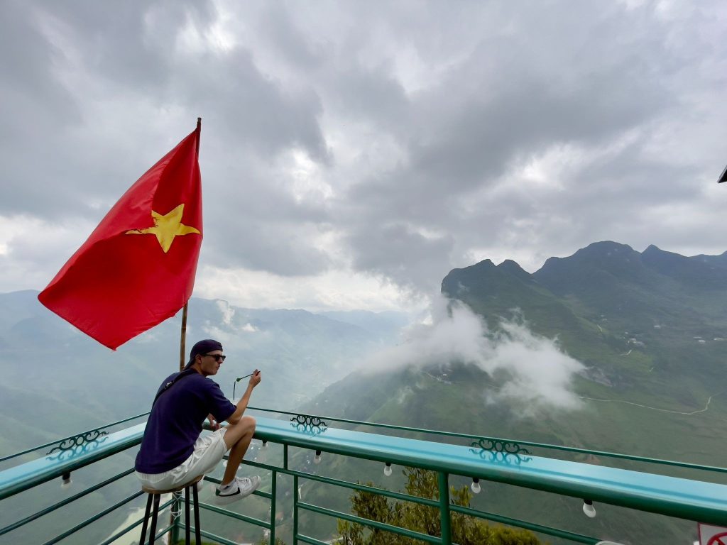
Heaven’s Gate – Cổng Trời (Summit Viewpoint)
- Location: 4C Highway, Quan Ba – about 40-43km to the north of Ha Giang City,
- The vibes: On clear days, you can see layered limestone ridges extending north and east, with the Nho Que River far below catching the light in the canyon. Late in the afternoon, when the sun drops behind the western ridges, it casts long shadows across the karst formations, turning the gorge golden. This is the single best light for photography at the summit
- Key highlights: This is the highest accessible point on the road and the classic stopping spot for panoramic shots.
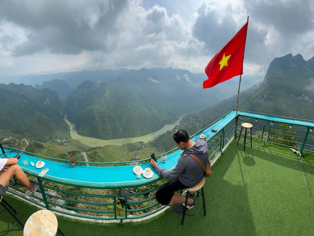
Coffee Mí Pó
- Location: Ha Sung Village, Pa Vi Commune, Meo Vac District, Ha Giang Province (now becomes Tuyen Quang Province).
- Opening hours: Usually from 06:00 to 18:00 daily.
- The vibe: The ultimate spot to sip Vietnamese coffee while overlooking Tu San Canyon. The road up here is steep and narrow, but the unobstructed views of the emerald Nho Que River are worth every twist.
- Bonus: They offer a flycam service to record cinematic footage of yourself admiring the impressive natural scenery with a cup of Vietnamese coffee.
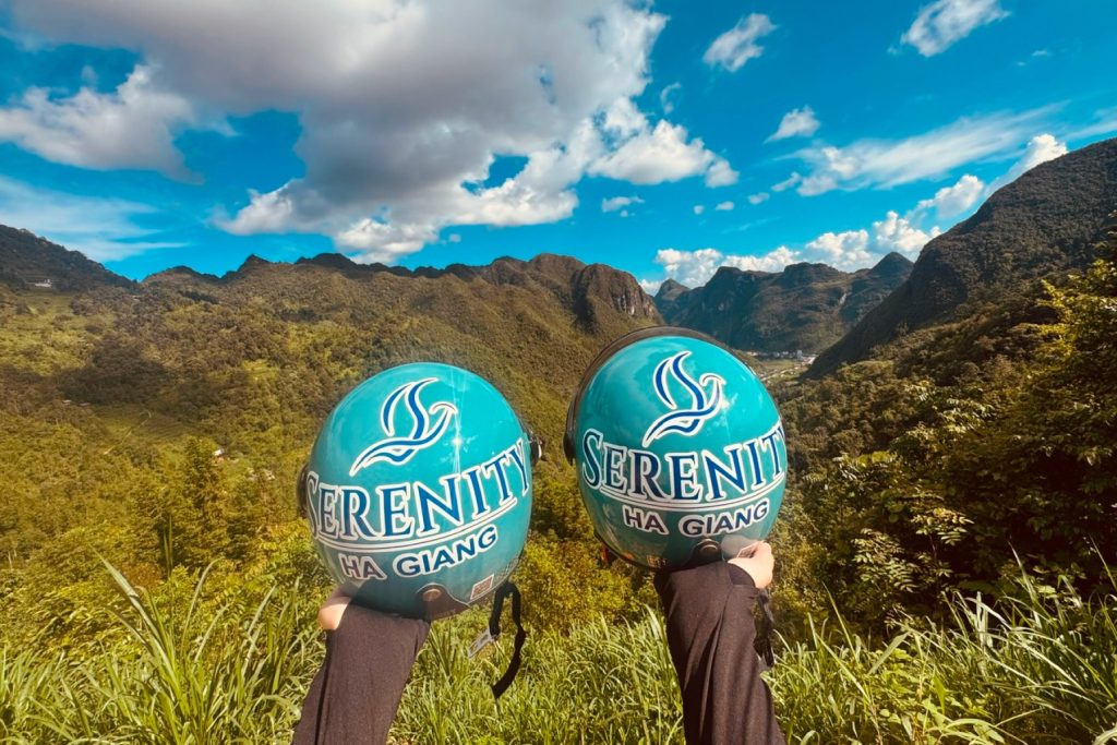
If you explore Ha Giang Loop with Serenity Ha Giang, you will have a chance to enjoy coffee with a panoramic view from Mí Pó Coffee – the highest point of Ha Giang.
Ha Giang Skywalk (Ma Pi Leng Skypath)
- Location: Next to the main Ma Pi Leng mountain pass, the section connecting Dong Van and Meo Vac.
- The vibe: A narrow path cut along the face of the limestone cliff – separate from the main highway – gives you a perspective you simply cannot get from the road. You see the full scale of Tu San Canyon opens below you with nothing between you and the 700+ meter drop.
- Key highlights: The trail is primarily accessible on foot or by motorbike along its shorter sections.
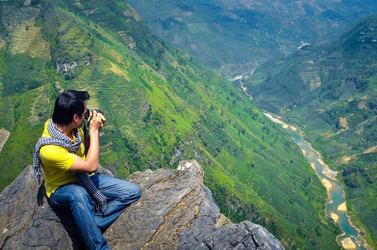
Nho Que River Pull-Offs
- Location: On the Ma Pi Leng Pass main highway.
- The vibe: The turquoise water against grey limestone is the defining visual of the entire Ha Giang Loop.
- Key highlights: If the light is right, ideally in the morning before midday haze sets in, these spots produce the kind of photos that explain why Ma Pi Leng Pass ends up on every Ha Giang travel list.
Photography Tips
- Ride Dong Van → Meo Vac direction to keep the gorge on your left (the photogenic side).
- Golden hour runs approximately 5–6 am and 4–5 pm, depending on the season.
- On high-altitude mornings, clouds settle in the valley below the road, known locally as “cloud hunting”, and you can ride above a sea of mist.
- Expect to plan your shot before parking. Pull-off space is limited and narrow.
Want to experience every viewpoint without managing the road yourself? Serenity Ha Giang’s guided tours include all major Ma Pi Leng stops with a local expert who knows exactly when and where the light hits best. Explore our Ha Giang Loop tours →
How to get to Ma Pi Leng Pass Ha Giang?
Step 1: Reach Ha Giang City
Ha Giang City is your starting point. From Hanoi, you have three practical options:
- Sleeper bus: Departs from My Dinh bus station or Hanoi Old Quarter. Journey time is approximately 6–8 hours overnight or during the daytime. Budget-friendly and efficient.
- Private car or luxury cabin: Several operators run direct Hanoi–Ha Giang transfers. Comfortable, door-to-door, and typically takes 5–6 hours.
- Self-drive or motorbike from Hanoi: Experienced riders take this route via National Highway 2. Allow a full day. However, if you are not familiar with driving in Vietnamese traffic, it is better to go with one of the above options.
View more options to travel to Ha Giang in this detailed guidance.
Step 2: Ha Giang City to Ma Pi Leng Pass
From Ha Giang City, Ma Pi Leng Pass is approximately 150 km via Highway 4C. The standard route follows: Ha Giang City → Quan Ba → Yen Minh → Dong Van → Ma Pi Leng Pass → Meo Vac. Plan for at least a full day of riding or driving with stops. Most travelers do this as part of their day 3 of the Ha Giang Loop itinerary (spending the first day from Ha Noi to Ha Giang City, 2nd day to Dong Van). This is the optimal route that saves you more time to visit the places.
Transportation options from Ha Giang City:
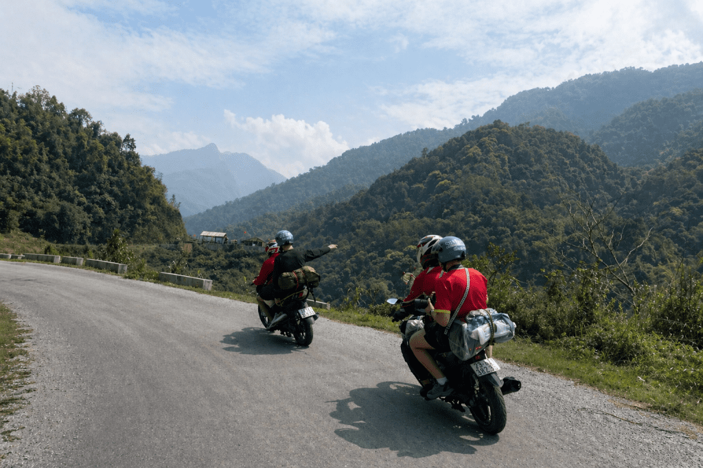
- Easy Rider tour: A local guide drives, you ride pillion. You get all the views with none of the riding pressure. Guides double as cultural interpreters, flagging stops and stories that solo riders miss entirely. This provides extra safety and peace of mind for any travellers who want to enjoy Ha Giang’s beauty on the road and have little to no riding experience.
- Private car: Ideal for families, couples, or anyone who wants the scenery without the exposure. You stop at all the same viewpoints – just in a vehicle. Increasingly popular and fully viable.
- Motorbike: Rent a manual or semi-automatic bike in Ha Giang City (average $6–$24/day). You set your own pace, stop anywhere, and get the full immersive experience. Requires genuine confidence on steep, narrow mountain roads.
Not sure which option fits your group? Serenity Ha Giang offers Easy Rider tours, private car transfers, and fully guided Ha Giang Loop packages. Check availability and book here →
Tips for Visiting Safely
Ma Pi Leng Pass is genuinely beautiful and genuinely dangerous. The road is narrow, exposed, and in sections has no guardrail between you and an 800-meter drop. None of that should stop you from going, but it should inform how you prepare.
- Check road conditions before you leave Dong Van: In the rainy season (May – September), sections of Highway 4C can become slippery or blocked by rockfall. Even in the dry season, morning mist and damp patches near waterfalls require caution. Ask locally the morning you plan to ride. In case you go on a tour, for example, with Serenity Ha Giang, the tour guide will check this. You just need to sit back and relax.
- Start early: During summer, try to become an “early bird” and aim to reach the summit between 7 and 9 am. You get the best light, lighter traffic, and you avoid the worst of the afternoon heat. Visibility also tends to be clearest in the early morning before haze builds.
- Ride the pass slowly: On paper, 20 km looks like a 30-minute drive. In practice, it takes 90 minutes minimum if you stop, and you will want to stop constantly. Don’t schedule anything immediately after.
- Fuel up and carry water before you leave Dong Van: There are no fuel stations on the pass itself. One small roadside stall operates near the main viewpoint, but supplies are limited. Stock water and snacks before you start. (If you go with Serenity Ha Giang, you don’t need to worry about petrol)
- Wear appropriate gear: Temperature at the summit can be 8–12°C cooler than Ha Giang City at ground level. A windproof layer is essential even in summer. In the wet season, full waterproofs are non-negotiable. You will have all the gears prepared beforehand if you go with Serenity Ha Giang Tour.
- Helmets are not optional: Rent from operators who provide full-face or, at a minimum, certified half-helmets. Standard rental helmets can be inadequate – inspect the chin strap and shell condition before accepting.
- If you’re not a confident rider, hire a guide. This isn’t a commentary on your ability; it’s for safety. Roads this narrow, this high, and this winding demand experience and focus. An Easy Rider lets you look at the view instead of the road. Plus, the riding is quite exhausting. Going with an easy rider can save you strength and time to explore the stunning view and the unique culture of Vietnam’s highlands.
Let’s experience Ma Pi Leng Pass the right way!
Ma Pi Leng Pass rewards visitors who approach it with patience and the right preparation. The views at Tu San Canyon, the cloud-hunting at dawn, the Skywalk trail along the cliff face, the emerald river far below, none of it disappoints. What disappoints is rushing through, missing the light, or spending the whole pass gripping handlebars in stress instead of looking up.
Serenity Ha Giang designs its Ha Giang Loop itineraries specifically around the best of this pass – the right timing, the right stops, and local guides who have ridden it hundreds of times. You have the options of a 2, 3, or 4-day itinerary to choose from. Whether you’re looking for a supported Easy Rider day, a multi-day loop package, or simply advice on planning your own route, we’re here to help. Book your trip with Serenity Ha Giang today!