Guide to Lung Cu Flag Tower | Ha Giang’s Northernmost Point
Ever wondered what it feels like to stand on top of the world? Well, Lung Cu Flag Tower is the closest you will get in Vietnam today. Standing near Vietnam’s symbolic northernmost point, Lung Cu Ha Giang is the kind of place that makes you stop and feel something – and not just because you’ve just climbed hundreds of stone steps to get there.
In this article, let’s explore all the feelings that this stop can contribute to your Ha Giang Loop trip. Spoiler: your thighs will complain loudly, but your Instagram feed will forgive you instantly.
Key Takeaways
- Location: Lung Cu Commune, Dong Van District, Ha Giang Province – approximately 24km north of Dong Van town, around 45 minutes to 1,5 hours of transportation.
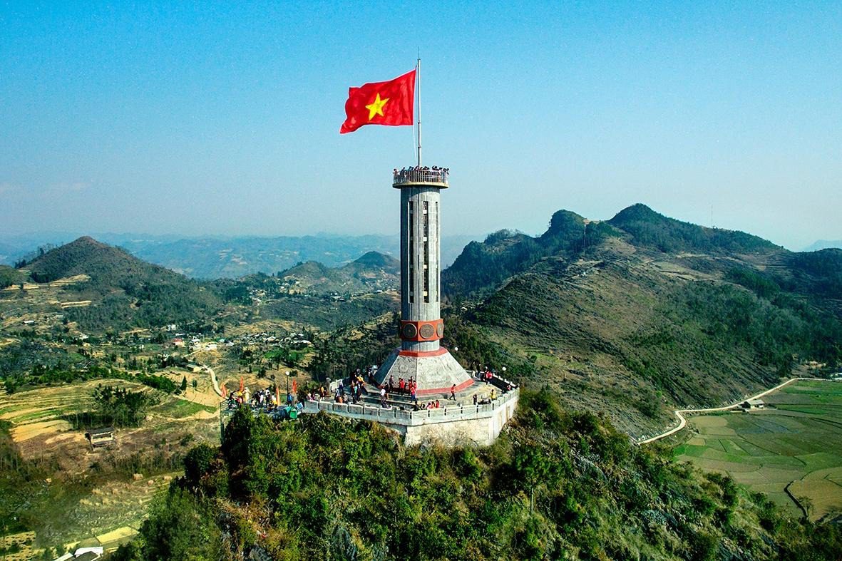
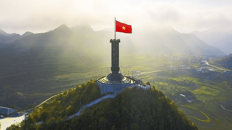
- Altitude: The tower sits on Dragon Mountain at approximately 1,468m above sea level.
- The flag: 54m² in area, representing Vietnam’s 54 ethnic groups – every flag flown here carries a serial number.
- The climb: Expect 279 stone steps to the tower base, then ~135 spiral stairs inside the tower itself.
- Best time: October – November (post-harvest, clear skies) and March – April (wildflowers, warm weather) offer the most rewarding visits.
- Admission: Approximately 25,000 VND per person; open daily 08:00 – 17:00.
Historical Significance of Lung Cu Flag Tower
Lung Cu has not always been a tourist destination. For over a thousand years, it was a territorial statement – a place where Vietnam said: “This far, and no further.”
Overview of the historical weight of Lung Cu Flag Tower:
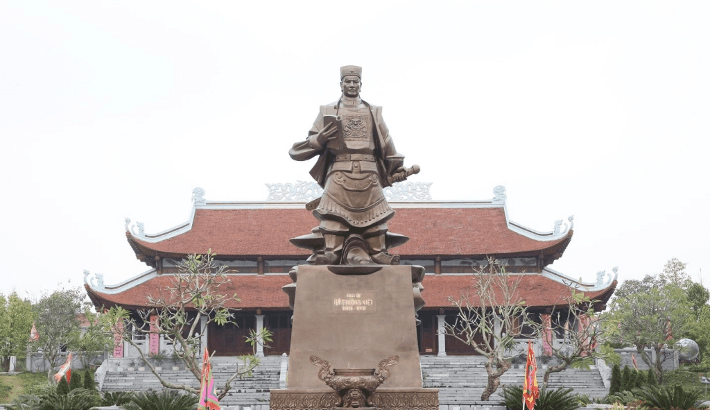
- The Origins: The story began in the 11th century when General Ly Thuong Kiet planted a wooden flag pole (made of Sa Moc tree) to mark the border of Đại Việt. Later, in the 18th century, King Quang Trung placed a giant bronze drum here, struck every two hours day and night to assert sovereignty.
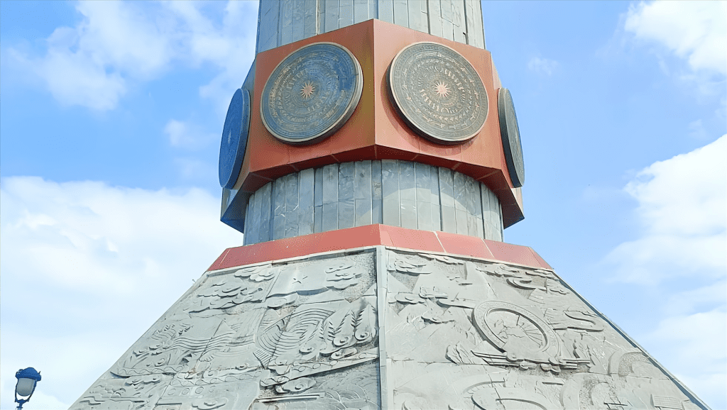
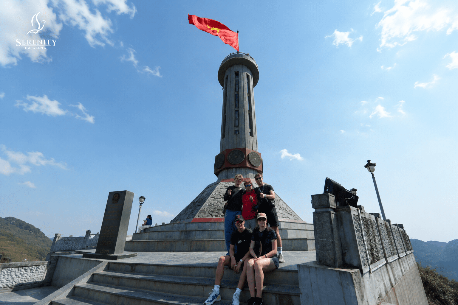
- The Modern Tower: The present octagonal tower, designated a National Historical Monument in 2009, was heavily inspired by the Hanoi Flag Tower. Its base is wrapped in Dong Son bronze drum motifs, honoring the cultural roots of the nation.
- The 54m² Flag: Today, the national flag flying above measures exactly 54 square meters, representing Vietnam’s 54 recognized ethnic groups. Every flag flown here carries a serial number. When torn by harsh mountain winds, it is respectfully retired and archived.
Deep dive into each milestone of Lung Cu Ha Giang:
10th – 11th century: The first flag by Ly Thuong Kiet
Under the Lý Dynasty, the great general Lý Thường Kiệt marched troops to the northern frontier and planted a flagpole on Dragon Mountain. The pole was first made from a Sa Moc tree. And it wasn’t symbolic in the decorative sense – it was a declaration of sovereignty, driven into the ground at the edge of Đại Việt. The mountain had a name. The border had a marker. Vietnam had a north.
18th century: The drum that never let them forget King Quang Trung
After Vietnamese forces defeated the invaders, King Quang Trung didn’t just celebrate – he installed a large bronze drum at the summit. It was struck every two hours. Day and night. And that drum beat was a reminder to anyone within earshot that this land was claimed, defended, and occupied. Therefore, this place is also called Long Cổ (King’s Drum).
1887: The unwavering will to preserve Lung Cu
During the colonial period, the French and Man Thanh intended to take this area for China, but they were stopped by the unwavering will of the Vietnamese people. The French, whatever their reasons, gave it permanence in stone and scale. The present octagonal tower, inspired by Hanoi Flag Tower, is the result of multiple reconstructions over the years.
1992 – 2010: Restoration, piece by piece
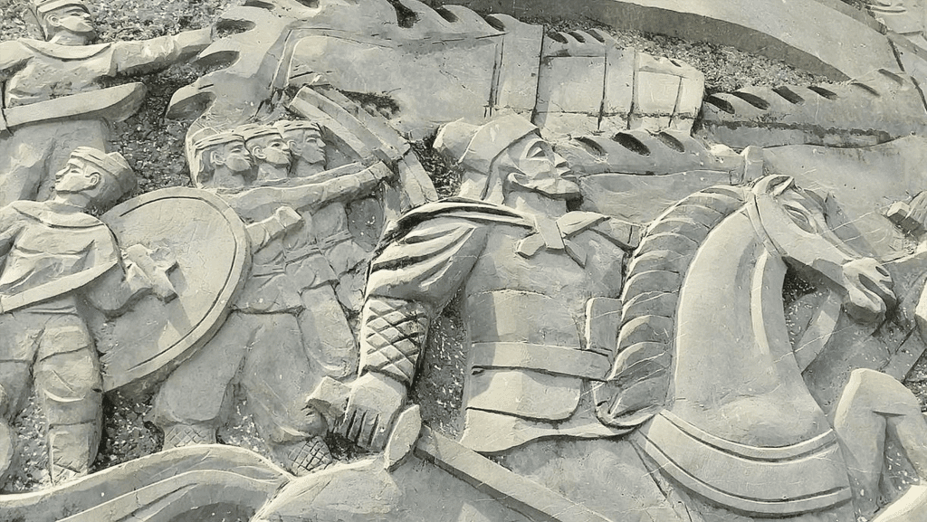
The tower was restored multiple times across this period, with the most significant work adding the eight Dong Son bronze drum reliefs wrapping the base and the eight stone bas-reliefs depicting Vietnamese history and the cultural traditions of Ha Giang’s ethnic minorities. Each restoration added detail. Each detail added meaning.
1994 & 2009: Official recognition
The site was designated a Vietnamese cultural heritage site in 1994. In 2009, it received the classification of National Historical Monument – the formal acknowledgement of what people had already understood for a long time.
Today: 54 square metres of flag
The Vietnamese national flag flying above the tower measures exactly 54m² – one square metre for each of Vietnam’s 54 recognised ethnic groups. Every flag flown at Lung Cu carries a serial number. When wind and weather wear one out, it is not simply replaced – it is documented and retired. Even the flags have a record here.
One detail worth knowing: while Lung Cu is referred to as Vietnam’s northernmost point, the actual geographic extreme of the Vietnamese-Chinese border lies approximately 3km further north. The tower is the symbolic northernmost point, which is precisely why it carries such weight for Vietnamese visitors. This is a place people come to feel something about their country, not just to check a coordinate.
How to Get to Lung Cu Ha Giang
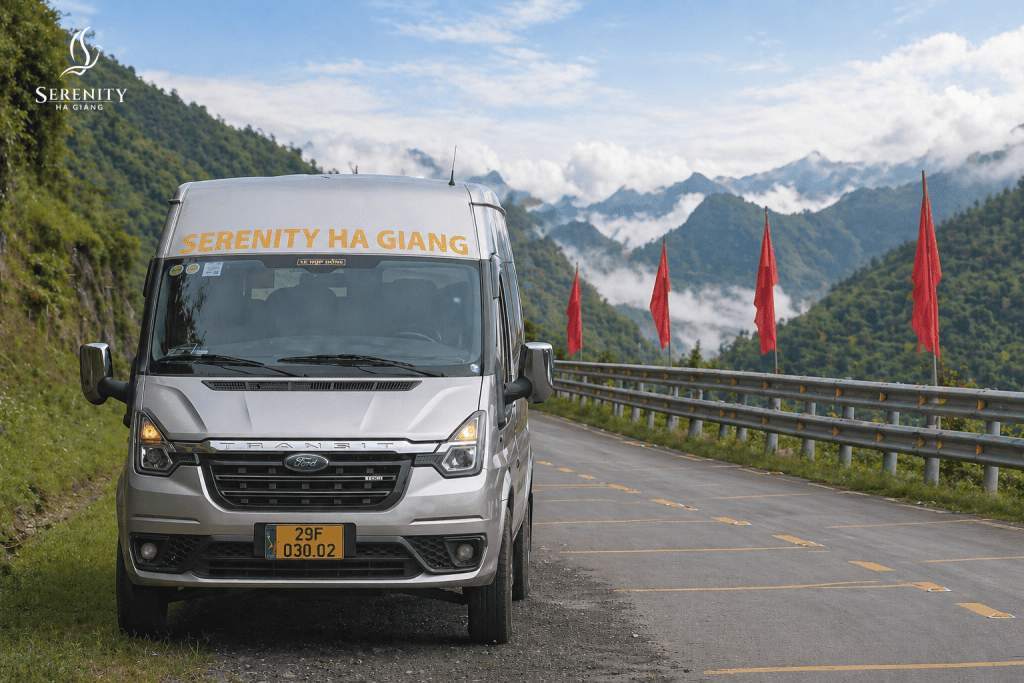
To reach Lung Cu Flag Tower in Ha Giang, first travel from Hanoi to Ha Giang City (6 – 7 hours by sleeper bus). From there, navigate to Dong Van Town (approx. 150 km) and drive the final 25 km north to Lung Cu via DT182 or QL4C.
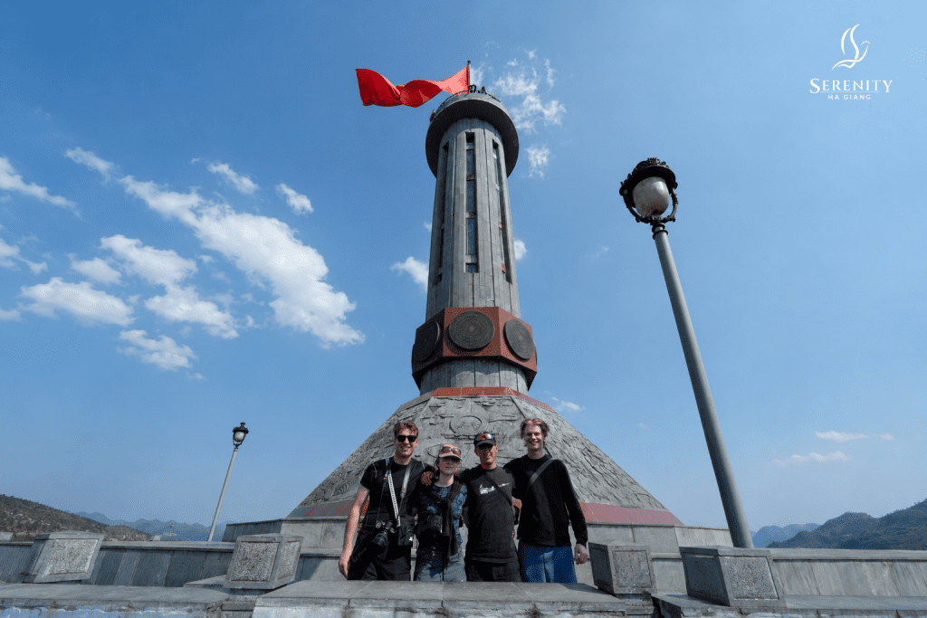
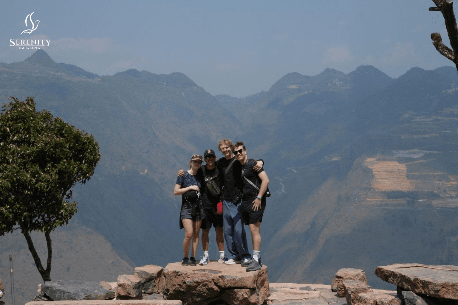
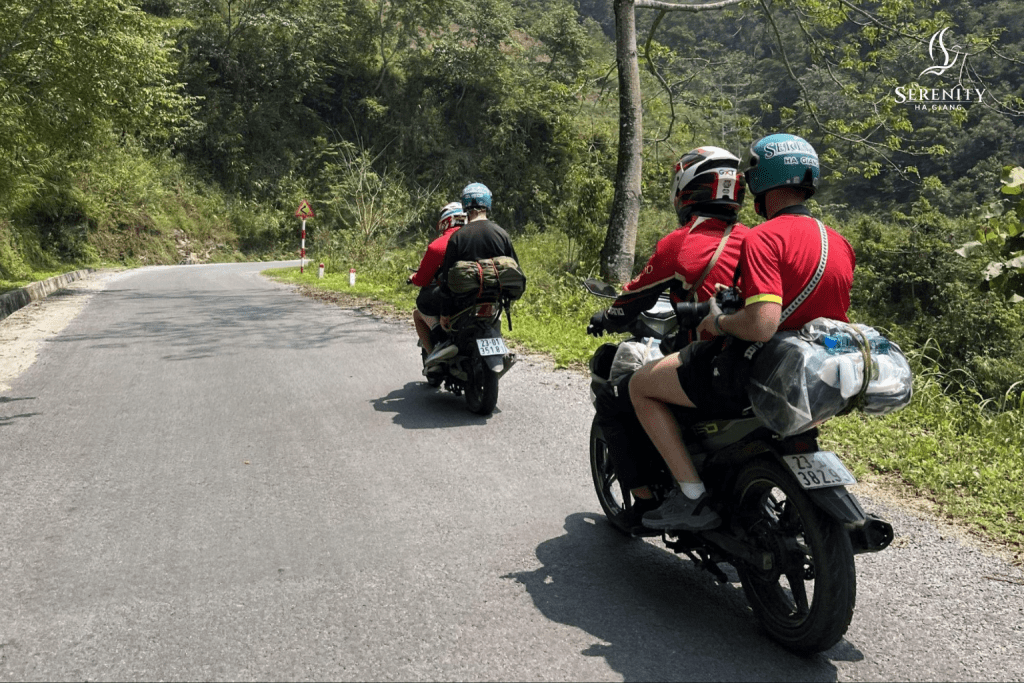
📌Note: If you need a quick, easy solution to visit Lung Cu Flag Tower in Ha Giang, go with a highly credible tour operator like Serenity Ha Giang. The tour provides a full package of transportation, accommodations, and local guidance, coming from Hanoi. Also, the Lung Cu Flag Tower is a must-visit place on the Ha Giang Loop tour. Therefore, no need to worry about missing this signature spot during your trip. You will also have an Easy Rider to ride the bike for you and tell you the stories of Lung Cu
Step 1: Hanoi to Ha Giang City
- Vehicle: Overnight sleeper bus (popular operators include Bang Phan, G8, or Hung Thanh).
- Duration: ~6 – 7 hours.
- Cost: 250,000 – 350,000 VND.
To understand more options to travel to Ha Giang from Ha Noi, check out this article about How to travel to Ha Giang.
Step 2: Ha Giang City to Dong Van Town
- Vehicle: Rental motorbike (if highly experienced in mountain riding) or a shared/private car with a driver.
Note: Normally Dong Van Town is included in a basic Ha Giang Loop tour, so you would visit it on your day 1 or day 2 with an Easy Rider or riding yourself.
- Route: National Road 4C (QL4C) passing through Quan Ba, Yen Minh, and Tham Ma Pass.
- Duration: 4 – 5 hours, depending on stops.
Step 3: Dong Van to Lung Cu Flagpole
- Distance: 24 km.
- Route: Follow the DT182 scenic route or QL4C up into the mountains.
- Duration: ~1 hour.
- Final Ascent: Once at the base of Dragon Mountain, you will need to climb 839 stone steps. If you are conserving energy, an electric cart is available that skips most of the climb, leaving only the final 200 steps to the top.
What to See and Do at Lung Cu Ha Giang
Lung Cu is not a full-day destination – but the hour or two you spend here has more texture than most sites on the loop. Here’s what you’re actually working with:
| Attraction / Activity | What is it? | What to expect / Tips |
| The Tower Climb | 279 stone steps + 140 spiral stairs inside the tower. | Steep but manageable. Take your time due to the high altitude. |
| The Summit View | A 360-degree panorama over the Dong Van Karst Plateau and China border. | If it’s foggy, wait 15-20 minutes at the top, the wind often clears the mist. |
| Lo Lo Chai Village | A traditional village of the Lo Lo ethnic group at the mountain’s base. | Look for distinctive clay houses and hand-embroidered textiles. Unhurried vibe. |
| Point 428 (The Real Border) | The true geographical northernmost point on the Nho Que River banks. | Takes ~2 hours of trekking through forests and fields. A hidden gem for adventurers! |
The Tower Climb
- What it is: Around 279 stone steps from the parking area to the tower base, then 140 spiral stairs inside to the viewing platform.
- What to look for: The octagonal exterior wrapped in Dong Son bronze drum motifs, and eight stone bas-reliefs at the base depicting Vietnamese history and ethnic minority culture.
- What to expect: Steep and exposed, but no technical difficulty. The altitude makes itself known – take your time on the way up.
The View from the Top
- What it is: A 360-degree panorama over the Dong Van Karst Plateau, the Vietnamese – Chinese borderlands, and the valleys and hamlets below Dragon Mountain.
- What to look for: Limestone ridges stacking into the distance, Hmong hamlets tucked into the valley folds, and the 54m² national flag directly overhead, catching the wind at full force.
- What to expect: Clear days reward you enormously. If the summit is fogged in on arrival, wait 20 minutes – it often clears.
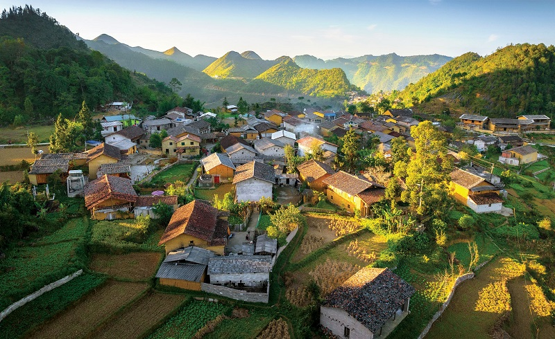
Lo Lo Chai Village
- What it is: A traditional village of the Lo Lo ethnic group, one of Vietnam’s smallest communities, sitting directly on the road between Dong Van and Lung Cu.
- What to look for: Distinctive stilt houses, hand-embroidered textiles, and daily village life that hasn’t been staged for visitors.
- What to expect: A quiet, unhurried stop – walk in slowly, buy something local, and allow at least 20 – 30 minutes. Morning light is best for photography.
Explore the “Real northernmost land”:
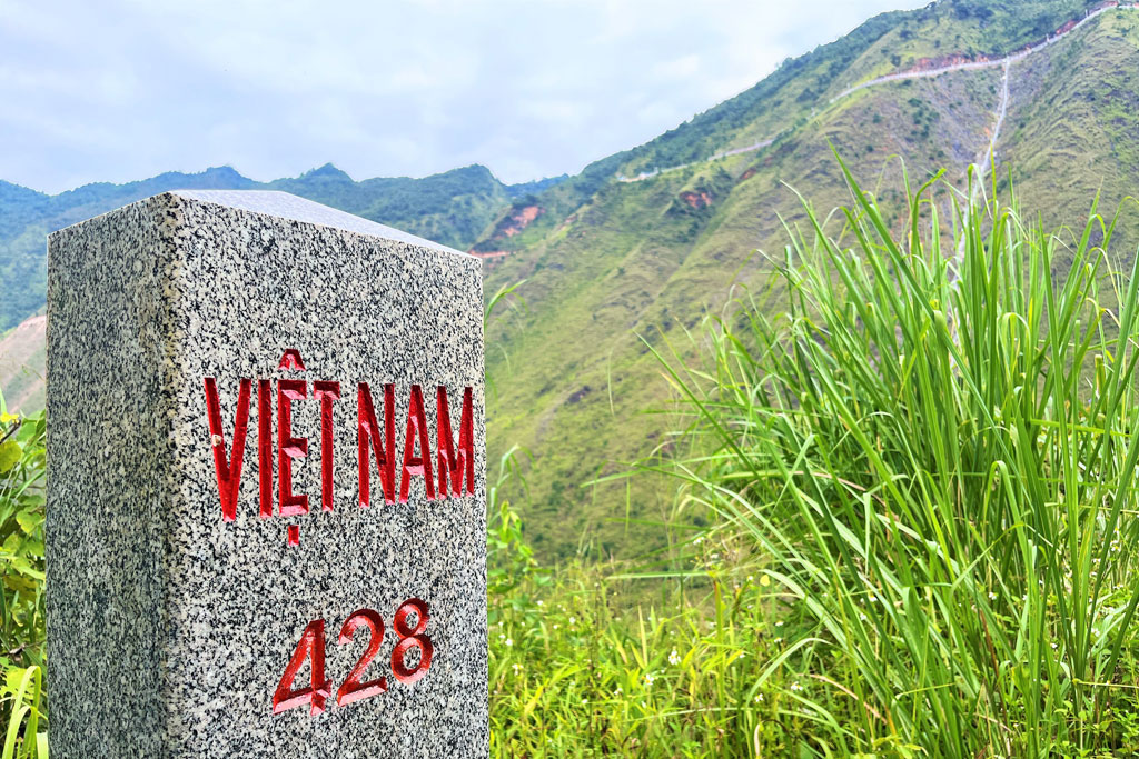
- What it is: The Lung Cu Flag Tower is the symbolic point of Vietnam’s northernmost. However, the true geographical point lies on the rocky banks of the Nho Que River – around 3.3 km from the Lung Cu Flagpole.
- What to look for: The stone marker known as Point 428 and the beautiful view towards the Nho Que River.
- What to expect: It takes about 2 hours to get there, because you have to follow a trail through rice fields and through the forest along the Nho Que River.
Best Time to Visit Lung Cu
Ha Giang’s weather varies significantly by season, and Lung Cu – sitting high on Dragon Mountain – is exposed to whatever comes.
| Season | Conditions | Verdict |
| Sep – Nov | Post-harvest, clear skies, golden terraced fields, mild temperatures | ✅ Best overall |
| Mar – Apr | Wildflowers (peach blossom, plum, yellow rapeseed), warming temperatures | ✅ Excellent |
| Dec – Jan | Cold, fog, occasional frost at altitude | ✅ Might face fog and cold temperatures; rewarding for experienced riders |
| May – Jun | Green terraces emerging, quieter crowds | ✅ Good, some rain risk |
| Jul – Aug | Heavy rain, slippery roads, poor visibility | ⚠️ Weather conditions are generally less ideal. |
September to November is the most popular window for the Ha Giang Loop overall, and for good reason: the rice terraces are golden, the skies tend to be clearer, and the temperature at altitude is comfortable rather than brutal.
If visibility drops significantly at Lung Cu, it is worth waiting at the base for a clear window before climbing. The tower offers nothing on a socked-in day.
Tips for Visiting Lung Cu Flag Tower
- Start early: Leave Dong Van early in the morning to reach Lung Cu before the midday tour groups arrive. Early morning light on the karst plateau is also considerably better for photography.
- Consider everyone’s physical condition: If you are travelling in a group, it is important to confirm the strength of each member because the climb is indeed challenging for children or the elderly.
- Dress for the altitude: Even in warmer months, the summit is exposed, and wind can make it feel significantly cooler than the valley. Bring a light layer, you can also avoid the sun exposure.
- Check road conditions locally: Road conditions between Dong Van and Lung Cu can change after rain or weather events. Ask your guesthouse or guide the morning of your ride – no website can give you real-time information on mountain roads. (If you go on a Serenity Ha Giang tour, the local guide will do this for you)
- Respect the space: Lung Cu is a place of strong national significance for Vietnamese visitors. Treat it accordingly – keep noise down near the flag ceremony area and follow any instructions from the site staff.
- Combine it smartly: The most efficient loop includes Lung Cu as a morning detour from Dong Van, with Lo Lo Chai village on the return, before continuing to Ma Pi Leng Pass and Meo Vac in the afternoon. This pacing works well for 3-day and 4-day loop itineraries alike.
How Lung Cu Fits Into the Ha Giang Loop
Lung Cu Flag Tower is one of those stops that earns its place on the map. It is not just a viewpoint or a historical footnote – it is a place that has marked Vietnam’s northern edge for over a thousand years, and standing at the top under a 54-square-metre flag with limestone ridges disappearing into China on one side makes that history feel immediate.
As a result, Lung Cu Ha Giang is most naturally visited as part of a 3-day or 4-day Ha Giang Loop. It sits geographically at the northern apex of the loop – beyond Dong Van, before the route turns south toward Ma Pi Leng Pass. Most riders reach it on Day 2, with Dong Van as the overnight base.
If you are planning a self-guided motorbike ride and want to make sure Lung Cu fits into your itinerary without sacrificing Ma Pi Leng or Meo Vac, this Ha Giang Loop itinerary guide walks through the pacing in detail – including how to balance the northern detour with the southern highlights.
The best Ha Giang Loop routes aren’t rushed – they’re planned. If you want Lung Cu to feel like a destination rather than a checkbox, Serenity Ha Giang’s guided tours are worth a look: small groups of no more than 10 travelers, private bungalow stays, and local guides who know exactly when to slow down. Book early to secure your spot and enjoy the beauty of Ha Giang.
Note: Lung Cu Flag Tower belongs to Ha Giang, which has now become Tuyen Quang since July 2025.
FAQ
To reach the top of the Lung Cu Flagpole, visitors need to climb a total of 839 stone steps. The climbing is divided into 3 stages:
– 1st stage: 425 steps, going from the foot of the mountain to the waiting area,
– 2nd stage: 279 steps, from the waiting area to the base of the flagpole.
– 3rd stage: 135 spiral steps located inside the flagpole, leading straight to the summit.
Yes. The ticket costs approximately 25,000 VND (~$1 USD) per adult. If you want to skip the first section of walking, you can pay an additional 15,000 VND for an electric buggy ride from the parking lot to the base of the stairs.
Mountain weather is unpredictable. If it’s completely “socked in” (whiteout conditions) when you arrive, don’t rush the climb. Sit at a local cafe in Lo Lo Chai village at the base, enjoy a cup of tea, and wait. The strong highland winds often blow the fog away, opening up clear visibility within 30-40 minutes